Showing posts with label Norway. Show all posts

Friday, 23 August 2019

Norway - Roadtrip, Forest & Such - 5


This morning I woke up quite refreshed but Ben hadn't really slept due to the cold. He was exhausted. After breakfast we tried to decide on what to see today. I had my mind set on Galdhøpiggen, the highest peak in Norway. Seeing the actual peak would've required a 2 hour hike and 600m ascent though, and we didn't really think that one was very plausible. We decided on driving along route 55 throught the mountainous area. The route passes by Jotunheim, the nature reserve of Galdhøpiggen, and crosses a plateau area at an altitude of 1300m.
All rivers we saw on the way were glacial water. Our first stop was at  Riddersprånget along the river Sjoa, The knights Leap the spot is called. The story is that a knight had fallen for someone elses bride. She had a liking for him too, so he stole her and they fled to the river where he jumped over a gorge with her in his arms. The other knights were chasing close behind, and he actually pushed one of his own men into the water to show the pursuers what would happen to them if they followed.
Our second stop was at Stuttgongfossen, a 22 m fall. The forest around the area was fabulous too. It was filled with moss-like lichen. There was so much of it that the forest bed was almost white grayish-green.


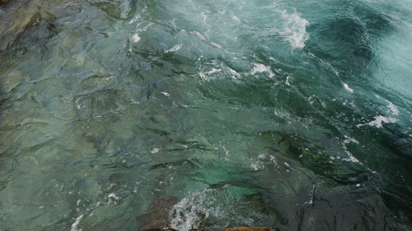
We drove upriver and after a while we reached a whole lake of glacial water. It was extremely beautiful and looked treacherously much like Mediterranean water. It almost beckoned one to come take a swim, but glacial water is FREEZING!


The route continued up to the plateau area where we ended up inside a cloud. The mist was so thick we had to creep forward carefully because we really couldn't see very much. This slow going kept on for quite a while,

until we began the descent.
Ben was freezing for a long time this day due to the previous chilly night. We decided on not sleeping outside the upcoming night, and instead did a long drive back over the border to Sweden. That night we spent back home.


Wednesday, 21 August 2019

Norway - Roadtrip, Forest & Such - 4

After breakfast and packing of gear we headed toward Molde. We had our goal set on Trollkirka/Trollkirkja this day. It is a cave complex, apparently the largest one in Sør-Norway. There is a bit of a hike before reaching the entrance at 484 m above sea level. The actual ascent I think is about 400 m. It was a bit more than I expected at first, but a slow and steady pace got my third trimester bump all the way up.
The trail starts at the fv64 road, by a parking lot. A lot of people stop here for the hike. We were a bit late as always and started out after 4 PM. The weather was shifty so we brought extra layers and rain clothing. The actual cave is cold, wet and dark so gloves, a hat and head torch is a must. Aside from that hiking poles are really good to bring at least for the descent. Oh, and bring water and a snack!

The trail starts out on flat gravel, after a while changing into a fur tree forest with a soft fur needle ground cover - almost like from a saga. After a while the angle of the trail increases and the forest changes to birch. There are lots of rocks all the way up so a careful footing is important.
After a while the trees give way to grass and smaller bushes.

There are a couple of resting spots on the way, but most people I think can do the hike without breaks. We stopped a few times, though and had a drink and a bite to eat.

The last part of the trek is the steepest and depending on weather it might be a bit slippery. There are parts with rope to hold on to in case the ground is wet.

The actual cave is made of three systems interconnected with a river. It is quite dark and torches are a must at least in the first part. Some bring helmets as parts of the cave are a bit low. I actually saw a few drops of blood on a rock, probably after a head bump into a rock.

At the end of the first cave there is a round room with a water fall. To the right from the entrance the route continues up through a tighter space. It was wet as we passed and the rock may be a bit slick. At this point our dad gave up and headed back toward the entrance.

Bro and I continued up and found another high ceilinged room with a water fall. The trail continued further up after that and there is supposed to be a third cave above, but that one we did not find. By then it was getting a bit late and we had to head back down the hill.

The descent was quicker, but not quick. The rocks were wet by that time and we had to check each step on the way down. Besides, dad and I are not very fit at the moment. This trek was a bit hard on my preggo belly and at times I had to take smallish breaks due to some Braxton-Hicks contractions that seemed to be provoked by the jolts of each step down the hill.


Besides I hadn't really trained for this trip, which I usually would have done before heading into mountainous terrain, so the muscles around my hip joints and lower back were a bit mushy at the end.

It was a great hike, though, even though bro was bored by the pace.

Afterward we hurried off to our next planned over night stop. We had to cross a fjord by boat, because driving would've been way too long. Norway is a pretty expensive country and each crossing by ferry is very expensive, so that has to be taken into account if traveling in Norway for a longer time. Luckily we only had 2 ferry crossings during our road-trip.

This night we again decided to stay indoors. We were so late that the probability of finding a good space for pitching a tent was diminishing.
We booked a tiny cabin at Romsdal campsite in Åndalsnes, very close to Trollstigen, "The troll's road".
We have been there before, but decided to go there once more. Last time we were there so late in the day, we really didn't have time to enjoy the pass.


So, next morning we did some stocktaking, re-packed, re-supplied and headed off to the pass.
Trollstigen is a winding road up to the plateau which lies at 858 m over sea level. There are a few hiking routes that go to the plateau from the bottom, but also ones that start at the plateau and go to the top and to the Troll wall, the tallest vertical rock face in Europe, with its 1100 m of sheer cliff wall. At its ridge summit it has an overhang of 50 m over the base. There are loads of climbing routes on the wall, many of which have been destroyed due to rock fall.
Anyway seeing that wall would have been fabulous, but the hike is 5 km and about an hour per km. Dad and I didn't have the strength and we didn't have the time to go there. Instead we did a nice and easy walk on the plateau and just enjoyed the view.

 Afterward we drove East between two massifs and stopped twice to look at some fantastic glacier water rapids.

We had way too time consuming stops again, exploring the rapids, so again we were late in finding a tent spot. Because of this we decided to pitch the tent at a camp site. It's a bit cheaper and there is the possibility of having dinner inside. As this was the chilliest area we've been so far, having the possibility to go inside was great. We hurried and pitched the tent under a tree, in case of rain, and headed inside for dinner. This night was actually very cold, and the temperature mark hit 5 degrees Celsius (41 F). I slept wearing layers and actually had a pretty ok night. Ben had to remake his bed during the night due to cold. He slept on a fairly big air mattress and those get really cold. He actually forgot to take the merino base layers into the tent that evening and didn't want to go look for them in the middle of the night, bummer. Dad squeezed himself into more clothing during the night and was able to sleep after that.


Monday, 5 August 2019

Outdoors and pregnant - 1 - where to go, what to do?

So, yes ... that happened.
I think I went a bit crazy suddenly and pretty soon I'll be not just me anymore. yay, pink fluffy puffy stuff and all, but how to do outdoors while preggo?
Later I'll write something on activities with kid, but first things first...

So, many women have a great pregnancy, they're energetic, do fitness training and everything and just seem to not change physically except for the bump. A colleague of mine was telling me about running around in the woods doing her exam to become a captain in the military, just days before full term. I was amazed that she could actually RUN! My body had no intentions of following that sort of a road. Already from the start I got super mega insanely exhausted. I've spent almost 3 months sleeping. After work I'd just crash and .. well,.. sleep like the dead. And eat. Yeah the eating part. My regular low carb, healthy, veggie rich diet did reeeally not go well with the growing, crazy, carnivore, sugar craving embryo, so I gained some weight quite quickly in the beginning trying to figure out how to eat. Luckily that part normalized, but I do feel pretty heavy. Aside from that an old pelvic injury started bothering me to no end.

So, no exercise and heavier than I'd hoped, but the craving to go outdoors has not lessened. So far I've spent a week at the coast with my bro, fishing and scrambling over boulders and rocks along the Swedish west coast, as well as done a cave scramble in Börsås - super much fun, very tight cave, and way too short. Took us 15 minutes to get through. In the pic I'm looking at the tiny exit hole. I couldn't find any good website on it, so try googling Börsås cave or check it out on youtube.


Anyhow, next I'm considering a slow pace hike in Norway or somewhere in Sweden and these are the things that need to be taken into account.
  • I'm not very fit at the moment.
  • I'm heavy - extra weight means weight of a backpack needs to be minimal as I have a bad knee and SI-joint.
  • Backpack can't be too tight around the waist - again, minimal weight.
  • Energy need is higher - need to have more snacks and stuff to keep a steady blood sugar level throughout any hike. 
  • Hiking pace needs to take a loose pelvis into account. Can't walk fast and no sudden moves.

Other than the above, it should be a piece of cake, right. 😅

Sweden?
I have never really explored Sweden. For some reason it has not been as interesting to me as more "exotic" places abroad. That said, the country has loads of interesting spots to offer and is full of forests, lakes and hills with hiking trails, fishing areas, rivers for kayaking and so forth...
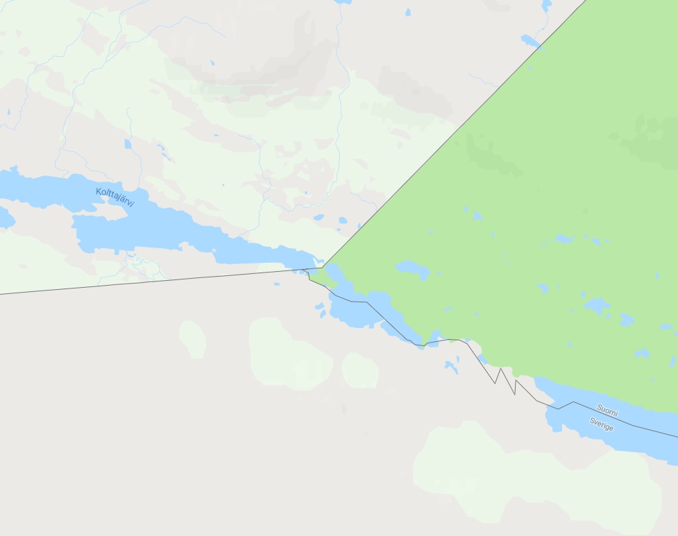
I've always wanted to go to Treriksröset, which is the place where Sweden, Finland and Norway meet, the "Three country cairn", but I'll have to save that one for later. Its as far up north you can get in Sweden. In the pic here you have Sweden below, Finland to the right and Norway to the left.


Norway?
So... Preikestolen for example, only has a 300 m ascent. There are 2 difficult sections, first one being in the very beginning of the hike. It's a constant scramble up a hill. Last time we were there it had been raining and the trail was quite muddy. We were late starting out our hike and didn't have time to go more than half way. So we stopped in the middle section and had dinner by a stream before heading down again. We couldn't go very far back then because we had our dad with us and he was in really bad shape (which he protests very loudly, not acknowledging that we only did the first part of the hike). If I go for this one I'll be the one who's in really bad shape. 😝

The mountainous Norway has a typical shifty weather, meaning you need to be prepared for both fabulous sunshine and sleet rain. If you want to spend the night at the top the gear you bring needs to accommodate cold and rain.

I considered Finland too, but that would require sitting still at the table visiting relatives. Not what I'm looking to do in my last days of FREEDOOOM!!!

So...
Tent with tarp.
Warm sleeping bag.
Base Layers - merino wool under layer, wool socks, etc
Layers - sweater, pants.
Water resistant layers - pants and jacket, buff, gloves etc.
Cooking gear. 
Head torch for moving about and to have as a light in the tent.
Water! and snacks....

So... my regular clothes are out of the question. I've ordered a new pair of pants for hiking, which hopefully will fit. I'll go with one of my old puffy jackets, a blue 8848Altitude, instead of my super efficient, Haglöffs ROC, fabulous shell jacket. That one will have to wait until next year... In this pic I'm wearing the super shell over a simple Quechua quilt jacket from Decathlon. It was insanely cold and windy on that mountain pass, but the combination was perfect for that weather.
The blue 8848 jacket survived a year of shifty weather on the Faroe Islands, though, so I think it'll be ok.

Well then, the first part of the project is finished - deciding to go.
Next comes packing for all eventualities. I'm planning on going super flexible as I haven't decided where to go and what to see. I just need my gear and a car and off it is 😜


Thursday, 8 November 2018

In retrospect - southern Norway- climb and drive, the ferry to Dk- Road trip westcoast and southern Norway_5


Our last day in Norway was fabulous. After a nice breakfast at our hotel we headed out toward Froland, a crag with 16 sports routes, ranging from 5 to 7a+.

Froland-crag

It is situated close to a town called Osedalen I think. We headed there first to get something for lunch and later on for some ice cream.


This is a pretty popular place and very easy to access. There is not super much space for cars, but I think we could squeeze in 4 or so. From there you cross a small stream and take a short, lovely forest path to the actual wall.

As we arrived there we met two guys, brothers, who had spent the night in the forest with tents and backpacks and were just about to head to the crag. Really fun way to travel.


At the crag there is a little postbox where you can find the topo and names of the routes.

The rock was fun to climb with good hand holds and spots for the feet and I tried one of the easier routes to the far right of the crag. Ben tried one of the more difficult ones to the left. Somewhere in the middle the more difficult and long ones are situated, the ones with overhang. I realized first hand why you should secure yourself to the ground if standing a bit off from the wall (there are spots for just that at this crag). At one point Ben fell a bit above the quick draw, his weight pulling me in. I wasn't secured so I more or less flew toward the rock face and he ended up falling 3-4 meters or so. Noob me. Noob!! I ended up laughing hysterically and the other climbers looked at us strangely...


We spent as much time here as we could before packing our gear together and heading further south toward Kristiansand.
We had a ferry to catch in the evening and a couple of hours of driving to do. On arrival in Kristiansand we found a nature reserve more or less inside town and made dinner there on a rock, before finally heading to the ferry and exiting Norway.

Saturday, 3 November 2018

In retrospect - Road trip on the Swedish west westcoast and southern Norway - Part 4


On a lovely sunny day we found our way to Ravnåskollen in Drammen, Norway.

Ravnaskollen-crag


Driving there went through some remote area with very few houses and we had a little bit of trouble finding the site at first. The last part to the site is a gravel route, and we had to use GPS to get there. You'll pass some single houses on the last part of the way and if I remember correctly there is a lake a bit off behind some forest to your right and the rise is on your left. At one point you come to a small open gravel area that could resemble a parking lot. There was nobody at the site when we got there, so not very crowded ;)

Probably there is a path up to the rock, but we didn't look for it. Instead we took the straight route up and the walk was short, but really very steep. The steep was covered with leaves and just a tad slippery, but with some struggle we got up to the rock.
There we found several sports climbing routes and this is where I did my first outdoor lead climb.

Ravnåskollen has 9 sports routes, the easiest being 4+ and the most difficult one being a 7a+. The 4+, called "De første stegene" or "The first steps" was my maiden climb (pic). As I have not done lead climbing indoors (which wise people consider to be the way to begin) this was an easy alternative way to start.  The rock had some lichen to be cleared away at each step. Wearing gloves might be an idea too depending on your skin status.

We had brought our picnic stuff and had coffee and snacks with us. We had a great weather with sunshine overhead and shade from the trees that surrounded us.
There were lots of signs of this being a moderately frequented spot, even if not as much as the previously mentioned Vindön. Nonetheless I guess we were just lucky to have all the space for ourselves.

Ben tried a 6a+ route among other routes here. The last one he did was "Opp til utsikten" - "Up to the outlook/view point". That is a long route of over 30 meters (pic) that seems quite fun. Abseiling down is not so bad either. :-)

At some point we realized we had to travel on, we had a hotel room waiting for us some ways off. So pack the climbing gear, dust off all our stuff - there are ticks in the Nordic forests, and off we drove.

The hotel I had booked had a sauna and a pool - one night in the forest in a tent, one night in a hotel with all extras. Whats not to like?
The hotel we went to was Arendal Herregaard Spa & Resort, a beautiful building placed near to the water in Arendal.The main building is visually very pleasantly decorated. Our accommodation was not so impressive, however. The room was tiny, the building had signs of age and water damage in the door so it was difficult to lock. The place was pretty nice even so.

We got there a bit late in the evening and hurried to get to the pool to get as much time there as possible. It's funny how childishly much you can enjoy splashing around in pool of water, no matter your age, your university years or how much authority you express on a regular work day. ;-) We spent the evening in the pool and sauna until the spa area closed.

The next morning we had breakfast included and I really enjoyed the buffet. The coffee was good, they had alternatives for allergics and they made omelettes on the go if you wanted that.

Our next goal on our super short, mega effective road trip was  Froland, a spot that also can be found in Arendal. All about that in the next post.


Friday, 19 October 2018

In retrospect - Road trip on the Swedish west westcoast and southern Norway - Part 2

When snorkeling and hanging out in Gothenburg was over and done with  (https://adventuresoup.blogspot.com/2018/10/in-retrospect-swedish-west-coast.html) the trip continued northward.

I'm a (forever) noob climber and my brother is really a more proficient one. The west coast is known for its many crags (check out 27crags.com) and he had found one that looked fun. We go to places where there are low grade routes for me and higher grade for him.

We brought all climbing gear (harness, shoes, carabiners, rope, helmets, gloves,  quick-draws) and headed off toward Uddevalla, a town that through history has been part of Sweden, Norway and Denmark in turns.. over and over...
Nowadays it's a pretty pleasant town, with a water front, hilly topography and lies close to interesting nature and towns.

The crag we decided to try out can be found on Vindön (wind island, red arrow.

https://27crags.com/crags/vindon

The area has a lot of interesting rock to climb and has 50 routes at levels from 4 traditional or 4+ sport to 6c+ traditional and 8a+ sport.
There is also a single boulder leveled 6b.
I had been climbing for several days already in a row (not a good idea) and my fingers and forearms were bummed.

The rock looks fun and there are quite many routes here. The longest routes, I think, are actually multi pitch (you climb up, secure yourself up there, bring your rope up and continue upward from that point - several pitches).

I didn't do a lot of climbing at Vindön. Instead I mostly stood on the ground and secured Ben, who on the other hand tried several routes, but he too had been climbing a bit more than usual. At some point we realized we had to keep traveling toward Norway. We decided that this place is so much worth visiting again.

As dusk made its way towards us we set off northward in my blue Peugeot. Driving in  Sweden is easy and the roads are good. Max speed is 120 kmh (130 kmh in Denmark) and there are loads of possibilities for a break on the road.

Quite soon we reached the Norwegian border. The border control is quite relaxed and doesn't cost anything.

Driving in  Norway is pretty much the same as in Sweden, but there are loads of road tolls, so you either should  register your car (so as not to receive the highest payable rate) or if you go there often, get an autopass.

http://www.autopass.no/visitors-payment

There are loads of tunnels in Norway. We only passed the ones near the border this time, but depending on where in the country you are you might be in really long tunnels, in sometimes steep angles, with intersections in the deep. Makes for some interesting driving.

By the time we got to Norway it was getting dark and we still had some ways to go to reach the area, Drammen, where we had planned on staying the night in a tent. More about that in the next post...